Geography of Rwanda
| ← Previous revision | Revision as of 12:25, 19 April 2026 | ||
| Line 23: | Line 23: | ||
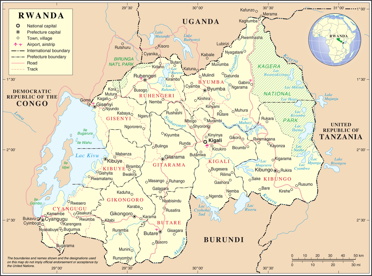
'''[[Rwanda]]''' is located in [[East Africa|Eastern Africa]], south of [[Uganda]], west of [[Tanzania]], north of [[Burundi]], and east of the [[Democratic Republic of the Congo]]. Rwanda is landlocked with no access to the sea. It lies a few degrees south of the [[Equator]] in the [[Great Rift Valley]], where the watershed between the [[Nile]] and [[Congo River|Congo]] river basins runs north–south through the country. The terrain is dominated by rolling hills and steep ridges, earning Rwanda the nickname "Land of a Thousand Hills". The west is marked by the [[Albertine Rift]] mountains, which include the [[Virunga Mountains]], a chain of volcanoes along the northwestern border; [[Mount Karisimbi]], the highest peak at 4,507 metres, lies within this range. East of the Congo–Nile divide, the land descends gradually toward the savannahs and wetlands of the [[Akagera National Park|Akagera]] basin. |
'''[[Rwanda]]''' is located in [[East Africa|Eastern Africa]], south of [[Uganda]], west of [[Tanzania]], north of [[Burundi]], and east of the [[Democratic Republic of the Congo]]. Rwanda is landlocked with no access to the sea. It lies a few degrees south of the [[Equator]] in the [[Great Rift Valley]], where the watershed between the [[Nile]] and [[Congo River|Congo]] river basins runs north–south through the country. The terrain is dominated by rolling hills and steep ridges, earning Rwanda the nickname "Land of a Thousand Hills". The west is marked by the [[Albertine Rift]] mountains, which include the [[Virunga Mountains]], a chain of volcanoes along the northwestern border; [[Mount Karisimbi]], the highest peak at 4,507 metres, lies within this range. East of the Congo–Nile divide, the land descends gradually toward the savannahs and wetlands of the [[Akagera National Park|Akagera]] basin. |
||
Rwanda's rivers drain into two major basins: the [[Nyabarongo River|Nyabarongo]] and [[Kagera River|Kagera]] feed [[Lake Victoria]] and the Nile to the east, while the [[Ruzizi River|Ruzizi]] drains [[Lake Kivu]] southward into [[Lake Tanganyika]] |
Rwanda's rivers drain into two major basins: the [[Nyabarongo River|Nyabarongo]] and [[Kagera River|Kagera]] feed [[Lake Victoria]] and the Nile to the east, while the [[Ruzizi River|Ruzizi]] drains [[Lake Kivu]] southward into [[Lake Tanganyika]], which eventually feeds the [[Congo River]]. Lake Kivu, one of the [[African Great Lakes]], forms much of the western border, with smaller lakes such as [[Lake Muhazi|Muhazi]], [[Lake Ihema|Ihema]], and [[Lake Burera|Burera]] scattered across the interior. |
||
Despite its proximity to the [[Equator]], Rwanda's high elevation gives it a temperate tropical highland climate, with two rainy seasons (March–May and October–November) and rainfall heavier in the western highlands than in the drier eastern lowlands. |
Despite its proximity to the [[Equator]], Rwanda's high elevation gives it a temperate tropical highland climate, with two rainy seasons (March–May and October–November) and rainfall heavier in the western highlands than in the drier eastern lowlands. |
||


