Grootfontein
create history and geography sections, dissolving "overview". Add historic population table. Improve 1 ref
| ← Previous revision | Revision as of 11:34, 27 April 2026 | ||
| Line 66: | Line 66: | ||
|population_as_of = 2023 |
|population_as_of = 2023 |
||
| ⚫ | |||
|population_note = |
|population_note = |
||
|population_total = 26,839 |
|population_total = 26,839 |
||
| Line 114: | Line 114: | ||
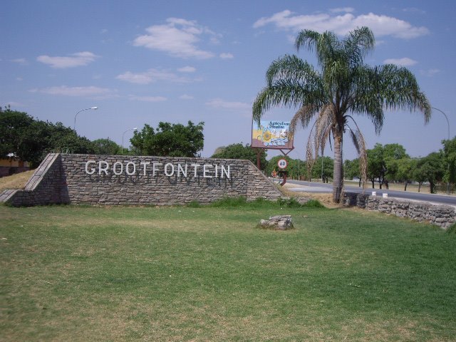
}} with 26,839 inhabitants in the [[Otjozondjupa Region]] of central [[Namibia]]. It is one of the three towns in the Otavi Triangle, situated on the [[B8 road (Namibia)|B8 national road]] that leads from [[Otavi]] to the [[Caprivi Strip]]. |
}} with 26,839 inhabitants in the [[Otjozondjupa Region]] of central [[Namibia]]. It is one of the three towns in the Otavi Triangle, situated on the [[B8 road (Namibia)|B8 national road]] that leads from [[Otavi]] to the [[Caprivi Strip]]. |
||
== |
==History== |
||
The place was known to the [[Herero people|Herero]] under the name ''Otjivanda''.{{cite news | title=Windhoek?! Rather make that Otjomuise | url=https://www.namibian.com.na/16007/archive-read/Windhoek-Rather-make-that-Otjomuise | last=Menges | first=Werner | newspaper=[[The Namibian]] | date=12 May 2005}} In 1885, 40 [[Boer]] families from the north-west of [[South Africa]] settled at Grootfontein. Part of the [[Dorsland trek]]kers, they were heading towards [[Angola]]. When that territory fell under [[Portugal|Portuguese]] control, they turned back and established the [[Upingtonia|Republic of Upingtonia]] at Grootfontein. Abandoned by 1887, it became the headquarters of the [[South West Africa Company]] in 1893. |
The place was known to the [[Herero people|Herero]] under the name ''Otjivanda''.{{cite news | title=Windhoek?! Rather make that Otjomuise | url=https://www.namibian.com.na/16007/archive-read/Windhoek-Rather-make-that-Otjomuise | last=Menges | first=Werner | newspaper=[[The Namibian]] | date=12 May 2005}} In 1885, 40 [[Boer]] families from the north-west of [[South Africa]] settled at Grootfontein. Part of the [[Dorsland trek]]kers, they were heading towards [[Angola]]. When that territory fell under [[Portugal|Portuguese]] control, they turned back and established the [[Upingtonia|Republic of Upingtonia]] at Grootfontein. Abandoned by 1887, it became the headquarters of the [[South West Africa Company]] in 1893. |
||
In 1908, the [[Roman Catholic church]] established a [[Mission (station)|mission]] in Grootfontein as the basis of their eventually successful attempt to establish missions in [[Kavango Region|Kavango]].{{cite book |title= Sata vuotta suomalaista lähetystyötä 1859–1959. II: Suomen Lähetysseuran Afrikan työn historia |trans-title= ‘One Hundred Years of Finnish Missionary Work 1859–1959. II: The History of FMS’s Missionary Work in Africa’ |last= Peltola |first= Matti |year=1958 |publisher=The Finnish Missionary Society |location=Helsinki |page=217 }} |
In 1908, the [[Roman Catholic church]] established a [[Mission (station)|mission]] in Grootfontein as the basis of their eventually successful attempt to establish missions in [[Kavango Region|Kavango]].{{cite book |title= Sata vuotta suomalaista lähetystyötä 1859–1959. II: Suomen Lähetysseuran Afrikan työn historia |trans-title= ‘One Hundred Years of Finnish Missionary Work 1859–1959. II: The History of FMS’s Missionary Work in Africa’ |last= Peltola |first= Matti |year=1958 |publisher=The Finnish Missionary Society |location=Helsinki |page=217 }} |
||
| ⚫ | {{Historical populations|2001|14,249|2011|16,632|2023|26,839|percentages=pagr|align=none|footnote=Sources:nsa2011>{{cite web | title=4.2.2 Urban population by Census years (2001 and 2011) | url=http://cms.my.na/assets/documents/p19dmn58guram30ttun89rdrp1.pdf | work=Namibia 2011 - Population and Housing Census Main Report | publisher=[[Namibia Statistics Agency]] | access-date=10 February 2026 | page=39}} |
||
| ⚫ | Like all the towns in the Otavi Triangle, Grootfontein is green in summer but drier in winter. |
||
| ⚫ | |||
| ⚫ | |||
==Economy and infrastructure== |
==Economy and infrastructure== |
||
The economic mainspring of the area were for many decades the Berg Aukas and [[Abenab]] mines to the north east of the town. These produced [[zinc]] and [[vanadium]] but have since closed. |
|||
===Transport=== |
===Transport=== |
||
[[File:Grootfontein Airport (2018).jpg|thumb|Military Airport and the town beyond|left]] |
[[File:Grootfontein Airport (2018).jpg|thumb|Military Airport and the town beyond|left]] |
||
| Line 131: | Line 131: | ||
===Agriculture=== |
===Agriculture=== |
||
''The Grootfontein Show'', an annual agricultural exhibition that has taken place since 1911,{{cite news | url=https://allafrica.com/stories/201109230986.html | archive-url=https://archive.today/20130221051202/http://www.newera.com.na/article.php?articleid=40818 | url-status=live | url-access=subscription | archive-date=21 February 2013 | title=Onÿarata @ Grootfontein Show centenary while The Wire storm the coastal towns | date=23 September 2011 |newspaper=[[New Era (Namibia)|New Era]] | publisher=via allafrica.com}} is the second largest annual entrepreneurial exhibition in the country, after the [[Windhoek Show]].{{cite news |
|||
''The Grootfontein Show'', an annual agricultural exhibition that has taken place since 1911,{{cite news |
|||
|url = http://www.newera.com.na/article.php?articleid=40818 |
|||
|archive-url = https://archive.today/20130221051202/http://www.newera.com.na/article.php?articleid=40818 |
|||
|url-status = usurped |
|||
|archive-date = 21 February 2013 |
|||
|title = Onÿarata @ Grootfontein Show centenary while The Wire storm the coastal towns |
|||
|date = 23 September 2011 |
|||
|newspaper = [[New Era (Namibia)|New Era]] |
|||
}} is the second largest annual entrepreneurial exhibition in the country, after the [[Windhoek Show]].{{cite news |
|||
|url=https://www.namibian.com.na/archive19982004/2004/september/national/046B5E1F0B.html |
|url=https://www.namibian.com.na/archive19982004/2004/september/national/046B5E1F0B.html |
||
|title=Farmer dies at Show |
|title=Farmer dies at Show |
||
| Line 149: | Line 141: | ||
}} |
}} |
||
== |
==Geography== |
||
| ⚫ | Like all the towns in the Otavi Triangle, Grootfontein is green in summer but drier in winter. In spring, [[jacaranda]] and [[Royal Poinciana|flamboyant trees]] bloom in profusion. The town has an old German [[Schutztruppe]] fortress from the year 1896, which today houses a [[museum]] that expounds on the local history. Namibia is a [[Dolomite (rock)|dolomite]] country and the [[carbonate]] deposits in the upper parts of the mine have yielded interesting [[fossil]]s of [[simian]] or [[pongoid]] creatures that lived millions of years before modern humans evolved. |
||
| ⚫ | |||
| ⚫ | |||
===Climate=== |
|||
Grootfontein receives an annual average rainfall of {{convert|557|mm}}, with a high of {{convert|956|mm|abbr=on}} in the 2010/2011 rainy season,{{cite news |
Grootfontein receives an annual average rainfall of {{convert|557|mm}}, with a high of {{convert|956|mm|abbr=on}} in the 2010/2011 rainy season,{{cite news |
||
|url=http://www.namibian.com.na/news/full-story/archive/2011/may/article/rainy-season-was-one-for-the-record-books/ |
|url=http://www.namibian.com.na/news/full-story/archive/2011/may/article/rainy-season-was-one-for-the-record-books/ |
||


